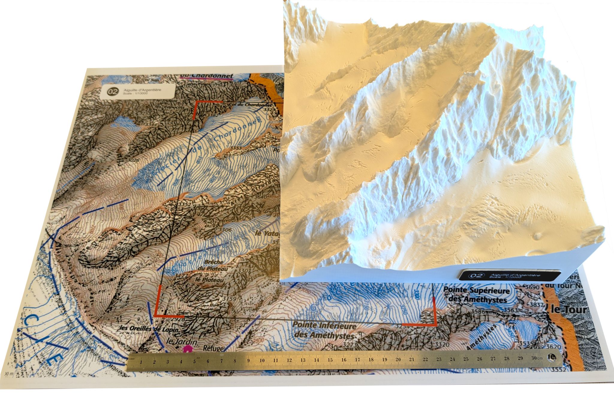
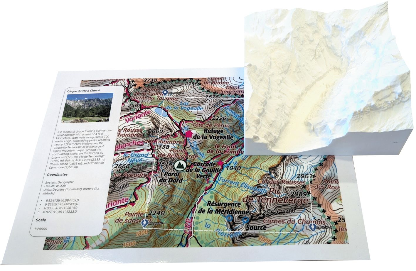
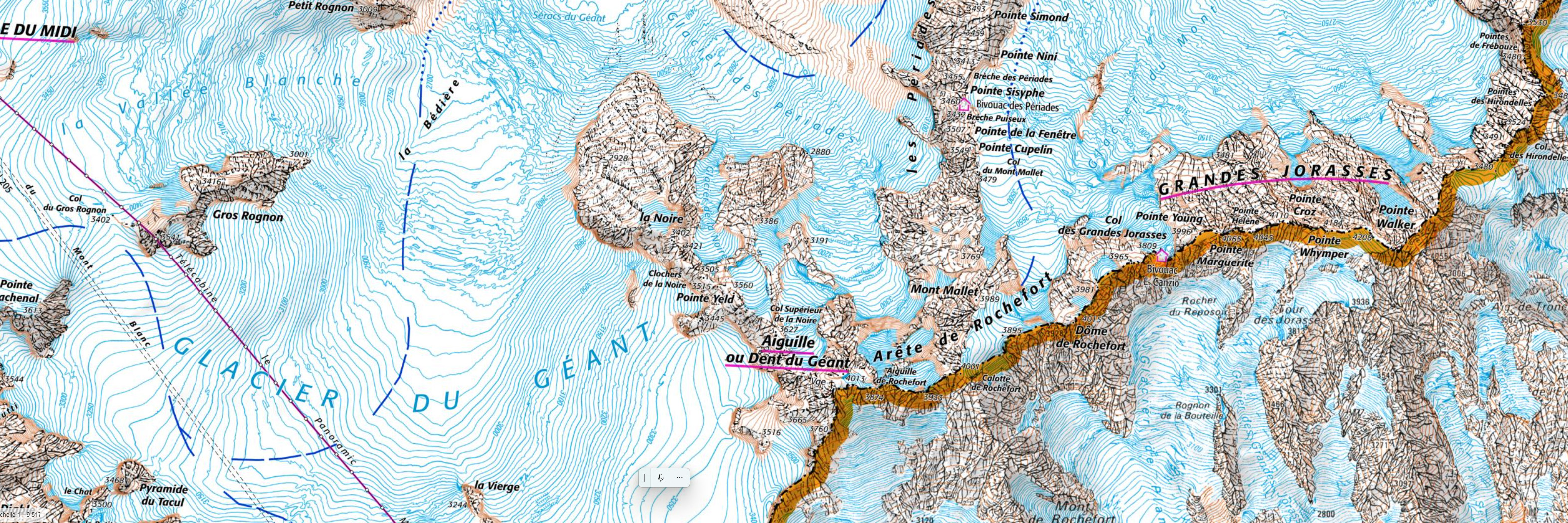
Geography Education · Custom Terrain Models

Touch the 3D.
Read the 2D.
The brain does the rest.

Custom 3D printed terrain models, interactive IGN maps and dedicated web platforms — built for your Geography curriculum, anywhere in the world.

Three deliverables.
One seamless experience.

Each project combines physical 3D terrain models with printed 2D maps and an interactive web platform — three tools designed to work together in the classroom.

01

Interactive Map

IGN topographic and satellite layers, live weather integration, and KML footprint — all in a Leaflet-powered map calibrated to your exact site.

02

3D Terrain Model

Printed from real LIDAR elevation data at true scale — no vertical exaggeration. 250 × 250 mm, 0.2 mm layer resolution, ready for classroom use.

03

Dedicated Website

A standalone page per site with coordinates, 3D viewer, map tabs and Google Earth link — hosted and ready to share with students via QR code.

From raw data
to classroom.

A fully integrated production chain — from satellite data to physical model to interactive web page.

STEP 01

Site selection

We identify the sites that match your curriculum — Alpine peaks, Pyrenean cirques, volcanic summits, or any terrain worldwide.

STEP 02

LIDAR processing

Raw elevation data from national or international sources is processed in QGIS and demo3d, with Lambert-93 to WGS84 coordinate conversion.

STEP 03

3D print & web build

The terrain model is printed at true scale. In parallel, the interactive website is built with maps, 3D viewer, and weather integration.

STEP 04

Delivery

You receive the physical models, the STL files, the deployed website, and bilingual IGN maps — everything ready for the classroom.

Choose your format.

Each option includes custom sites selected for your curriculum. All prices on request — every project is unique.

Digital
The full web experience for your sites — no physical model. Ideal for schools with their own 3D printing capability.
  • Dedicated website per site
  • Interactive IGN / satellite maps
  • 3D viewer (GLB file)
  • STL files for self-printing
  • KML footprints
On request
Bespoke
A tailored project for institutions with specific needs — custom scale, custom region, multilingual content, or integration with existing platforms.
  • Custom geographic region
  • Custom scale & format
  • Multilingual content
  • Presentation & training
On request
Aiguille d'Argentière — modèle 3D et carte IGN

Alpine Environments — Campus des Nations, Geneva

12 sites across the French Alps and Pyrenees, each with a printed terrain model, bilingual IGN maps, and a dedicated interactive web page. Initiated as part of a Design teaching project at the Campus des Nations, Geneva — now a reference tool used daily in Geography classes.

Explore the live site ↗

Every request starts with the brief.

To keep things clear and efficient, all project enquiries go through the brief form. It takes 5 minutes and gives me everything I need to come back with an accurate proposal.

Fill in the project brief →

Already filled in the brief? I'll reply within 48 h at laurent@moreau-fr.net